
Suggested Route (40.78km amended August 21, 2022)
We celebrate the Strade Bianche cycle race with an informal gravel ride featuring the ´Weißen Straßen´of Göttingen plus concrete, dirt, tarmac cycle paths and public roads.
The 40km suggested route (you can also follow your own path) begins at the Göttingen velodrome where soon after we hit the first of 28 gravel sectors (some are longer than others and are sub-sectioned). The tour features a climb at 10.5 kilometres (sector 7b – max 7.9% and a stiff but short climb at 24.4km (sector 16 – max 19.6%).
This short route has been extensively revised and at Ballenhausen we miss out a series of stinging hills featured on the other routes. We also miss out the Wendebach Stausse and the allure of pommes and beer, but we ride more gravel sectors.
This is an updated version of the route as of August 21, 2022.
Sorry, there isn´t a German language description for this ride.
The Route
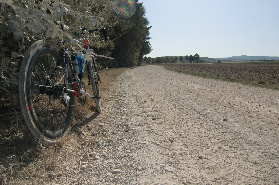
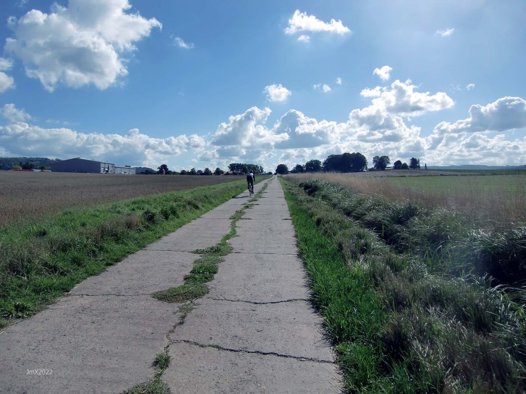
The route features a mix of gravel, dirt, concrete (farm/forest) plus tarmac public cycle paths and roads.
Concrete farm roads
The white roads aren´t the whole story though – a number of concrete farm roads are also included in this route. In regard to Roubaix, for example, people tend to fixate their minds on the cobbles, but that is only part of the battle to finish, there are also the tarmac roads where the wind seems to drive straight into your face. On the ´Gö Strade Bianche Homage Ride´ there are concrete farm roads which are anything but smooth, they can be very muddy and a challenge in themselves.
Start/Ziel Velodrom Göttingen – 28 gravel sektoren – zwei Steigungen max. 7,9 % und max. 19,6 %.
Ride: 40.78
Gravel: 21.8km
Farm roads-cycle paths/Landwirtschaftstraßen-Fahradwege: 12.29
Public roads/Öffentliche Straßen: 6.7km
Elevation: 276m
GPS Ride: https://veloklubhaus.com/2022/08/21/go-strade-bianche-40km-august-21-2022-gravel-road-ride/
GPS
Garmin Connect: https://connect.garmin.com/modern/activity/9447907529
Strava: https://www.strava.com/activities/7675318399
Komoot: https://www.komoot.com/tour/896710847
Sign
The route is not signed, we offer a GPS, but you can choose to follow your own direction.
Want to ride it?
This is an informal ride and a suggested route only. If you would like to ride it with us do make contact. Or of course you may ride it at your own time and if you do, it would be great to hear from you – https://veloklubhaus.com/contact/.
Achtung/Take Note
The Gö Strade Bianche is a suggested cycle tour route and not a race or a contest, should you choose to follow our description or a GPS of the outlined route you do so at your own risk.
It is your responsibility to ride in a safe and in a comfortable manner suited to your own estimated skill or fitness level.
Die Gö Strade Bianche ist ein Routenvorschlag für eine Fahradtour und kein Rennen oder Wettkampf. Solltest Du Dich dafür entscheiden, unserer Tourbeschreibung oder einem GPS der beschriebenen Route zu folgen, tust Du dies auf eigene Gefahr.
Du bist selbst dafür verantwortlich, entsprechend Deinem Können und Fitness-Niveau, so zu radeln, wie Du es Dir zutraust.
Gravel categories (this is purely subjective & made up by us)
We have graded the gravel 1 to 5 with 5 being the roughest (there is also an Hors Cat for very extreme).
Cat 1 – mostly hard packed and rideable on almost all bikes.
Cat 2 – often hard packed, a little rougher, potholes and challenging.
Cat 3 – loose surface, more ruts & potholes, gradient changes, bigger stones with greater caution required. (may include downhill or a turn)
Cat 4 – very rough, loose with larger stones and deep ruts/potholes.
Cat 5 – as 4 but may also be downhill, maybe tight turns or with single track and ruts.
HC – Mind bogglingly hard.
Summer/Somner Gravel
The Route
Sector/Category/@/Sector Length
Göttingen Velodrome @ 0, 0 km
If able you can elect whether to ride one 400 metre lap of the tarmac at the start and then another at ride end.

Note: Excercise extreme caution and a friendly attitude on the first section of the shared cycle/pedestrian path (also on your return to the velodrome).
Sector 1a – Cat 1 @ 1.6, 0.9km (a + b)

Sector 1b – Cat 1

Sector 2 – Cat 2 @ 3.0, 0.6km

Sector 3 – Cat 3 @ 3.5, 0.1km
Farm Yard, cobbles and loose large stones.

Sector 4 – Cat 2 @ 3.6, 0.2km
Brilliant white in the summer.

Sector 5 – Cat 2 @ 3.9, 1.3km.

Summer

Winter
Niedernjesa @ 8.0km
Sector 6 – Cat 1 @ 8.1, 1.4km

Obernjesa @ 9.5km.
There is a bakers in Obernjesa. (Bäckerei Könnecke, Dramfelder Str. 8)
Asphalt or cobbles at Obernjesa?

Sector 7a – Cat 2 @ 10.5, 0.6km (a+b

Sector 7b* – Cat 2 – Max climb 7.9% – 0.3km long
At the tree is a bench with a great view across the valley to Gö.

Sector 8a – Cat 1 @ 12.1, 0.5km (a+b)

Sector 8b – Cat 3

Sector 9 – Cat 2 @ 12.7, 0.4km

Sector 10 – Cat 3 @ 13.1, 0.7km

Sector 11a – Cat 2 @ 15.5, 0.7km (a+b+c)

Sector 11b – Cat 3 (Left turn)

Sector 11c – Cat 1

Autobahn A38 @ 16.3km

Sector 12 – Cat 2 @ 16.7, 0.2km

Sector 13a – Cat 2 @ 17.5, 1.7km. (a+b)
This fast sector crosses other farm roads so be watchful.


Sector 13b – Cat 1

Elkerhausen @ 19.5km
Sector 14 – Cat 2 @ 19.7, 2.1km.
A second time under the A38.


Klein Schneen @ 22.2km
Sector 15 – Cat 2 @ 23.1, 0.8km
There is an unlawful swimming lake on the right handside, be careful of the law abiding having a day off. There is usually a gate to stop the bathers parking their cars along the feldweg.

Sector 16* – Cat 4 @ 24.4, 0.4km. Climb Max 19.6%
Once over the rise it keeps going for a few hard pedal strokes more!

I would like to do some guerilla gardening here and plant Tuscan trees.
OR miss out this nasty hill by turning left along the Betonweg (0.4km), then turn right onto the gravel (0.5km) followed by going right on more Betonweg (0.4km). This will lead you back on route.


Groß Schneen @ 25.2km
There is a bakers in Groß Schneen. (Bäckerei Könnecke, Landstraße 22)
Cross the B27 with care!!!!
Sector 17a – Cat 1 @ 25.3, 0.5km (a+b)

Sector 17b – Cat 2.
Red Strade and in the summer it is bordered with wild flowers (unlike the winter as pictured).

Sector 18 – Cat 1 @ 28.0, 0.2km

Ballenhausen @ 28.8km
Sector 19 – Cat 2 @ 29.1, 0.7km

Sector 20 – Cat 4 @ 30.0, 0.9km Descent!
A gnarly descent – moderate your speed.

Sector 21a – Cat 2 @ 30.9, 0.4km (a+b)
If you wish you can continue to the B27 and miss out sector 21 (turning left to Stockhausen).

Sector 21b – Cat 3

B27 and Stockhausen @ 31.4km
Sector 22a – Cat 2 @ 32.0, 2.1km (a+b+c+d)
We join the Bahn to Neidernjesa.


Sector 22b – Cat 2

Sector 22c – Cat 2

Sector 22d – Cat 3

Neidernjesa @ 34.5km
Sector 23a – Cat 3 @ 35.0, 0.7km (a+b)
This section can get very muddy near end and also being deeply rutted.

Sector 23b – Cat 1

Sector 24 – Cat 3 @ 35.6, 1.1km
A gradual climb of the Weinzenberg where once a medieval warte stood (until 1570) part of a system of Landswehr and watch towers which watched over and controlled Göttingen.

Sector 25 – Cat 2 @ 36.9, 0.3km
Sector 4 reversed.

Sector 26 – Cat 3 @ 37.1, 0.1km
Sector 3 reversed – We return to Reinshof with its cobbles and large stones in the farm yard.


Sector 27 – Cat 2 @ 37.3, 0.6km
Sector 2 reversed and it is a nice flowing downward section. KEEP RIGHT!


Spring and Winter
Sector 28a – Cat 1 @ 38.6, 0.9km (a+b)
Sector 1 in reverse.

Sector 28b – Cat 1

Note: Watch out for walkers, be nice!
End at Velodrome @ 40.78km


The Route (list form)
Sector/Category/@/Sector Length
Sector/Category/@/Sector Length
Göttingen Velodrome @ 0, 0 km
Sector 1a – Cat 1 @ 1.6, 0.9km (a + b)
Sector 1b – Cat 1
Sector 2 – Cat 2 @ 3.0, 0.6km
Sector 3 – Cat 3 @ 3.5, 0.1km
Sector 4 – Cat 2 @ 3.6, 0.2km
Sector 5 – Cat 2 @ 3.9, 1.3km.
Niedernjesa @ 8.0km
Sector 6 – Cat 1 @ 8.1, 1.4km
Obernjesa @ 9.5km.
Sector 7a – Cat 2 @ 10.5, 0.6km (a+b
Sector 7b* – Cat 2 – Max climb 7.9% – 0.3km long
Sector 8a – Cat 1 @ 12.1, 0.5km (a+b)
Sector 8b – Cat 3
Sector 9 – Cat 2 @ 12.7, 0.4km
Sector 10 – Cat 3 @ 13.1, 0.7km
Sector 11a – Cat 2 @ 15.5, 0.7km (a+b+c)
Sector 11b – Cat 3
Sector 11c – Cat 1
Autobahn A38 @ 16.3km
Sector 12 – Cat 2 @ 16.7, 0.2km
Sector 13a – Cat 2 @ 17.5, 1.7km. (a+b)
Sector 13b – Cat 1
Elkerhausen @ 19.5km
Sector 14 – Cat 2 @ 19.7, 2.1km.
Klein Schneen @ 22.2km
Sector 15 – Cat 2 @ 23.1, 0.8km
Sector 16* – Cat 4 @ 24.4, 0.4km. Climb Max 19.6%
Groß Schneen @ 25.2km
Sector 17a – Cat 1 @ 25.3, 0.5km (a+b)
Sector 17b – Cat 2
Sector 18 – Cat 1 @ 28.0, 0.2km
Ballenhausen @ 28.8km
Sector 19 – Cat 2 @ 29.1, 0.7km
Sector 20 – Cat 3 @ 30.0, 0.9km Descent!
Sector 21a – Cat 2 @ 30.9, 0.4km (a+b)
Sector 21b – Cat 2
B27 and Stockhausen @ 31.4km
Sector 22a – Cat 2 @ 32.0, 2.1km (a+b+c+d)
Sector 22b – Cat 2
Sector 22c – Cat 2
Sector 22d – Cat 3
Neidernjesa @ 34.5km
Sector 23a – Cat 3 @ 35.0, 0.7km (a+b)
Sector 23b – Cat 1
Sector 24 – Cat 3 @ 35.6, 1.1k
Sector 25 – Cat 2 @ 36.9, 0.3km
Sector 26 – Cat 3 @ 37.1, 0.1km
Sector 27 – Cat 2 @ 37.3, 0.6km
Sector 28a – Cat 1 @ 38.6, 0.9km (a+b)
Sector 28b – Cat 1
End at Velodrome @ 40.78km
Want to ride it?
This is an informal ride and a suggested route only. If you would like to ride it with us do make contact. Or of course you may ride it at your own time and if you do, it would be great to hear from you – https://veloklubhaus.com/contact/.

