DE Home – ENG Home – DE Route – ENG Route
Manifest – Galerie – Jimi Hendrix – Links – Air War – WW2 – Gutingi Rides
Brevet Card – Facebook – Strava – Komoot
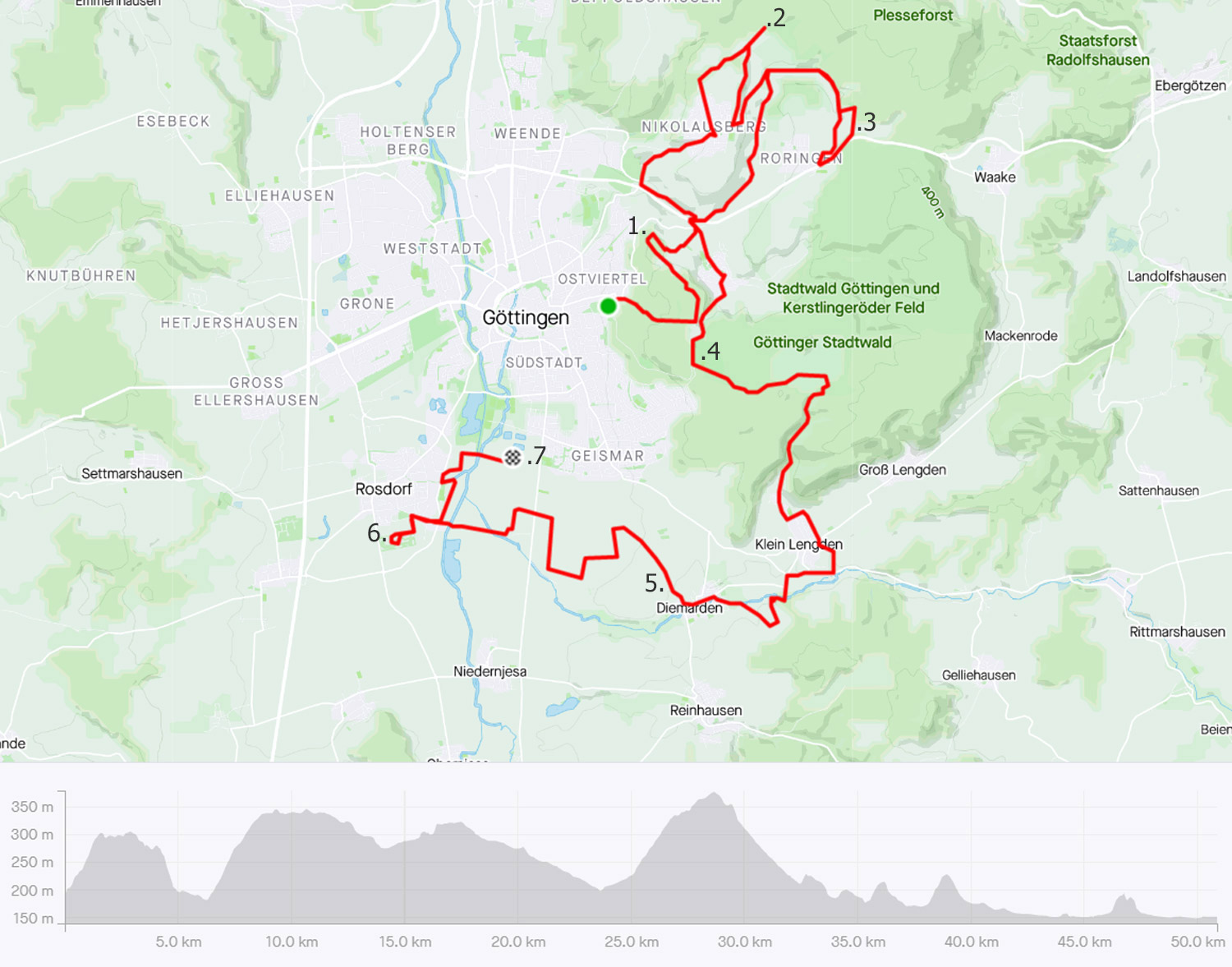
The Suggested Route
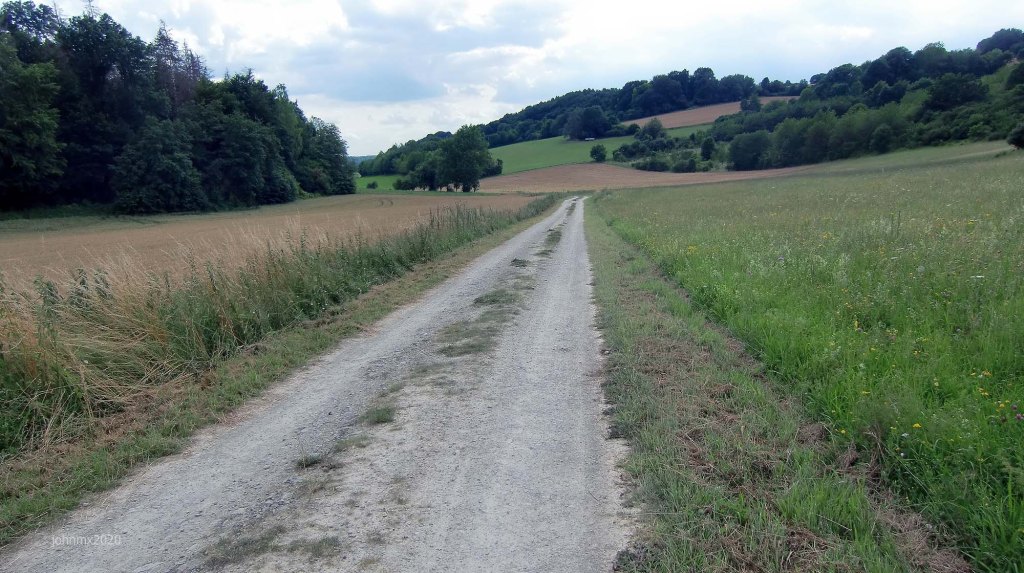
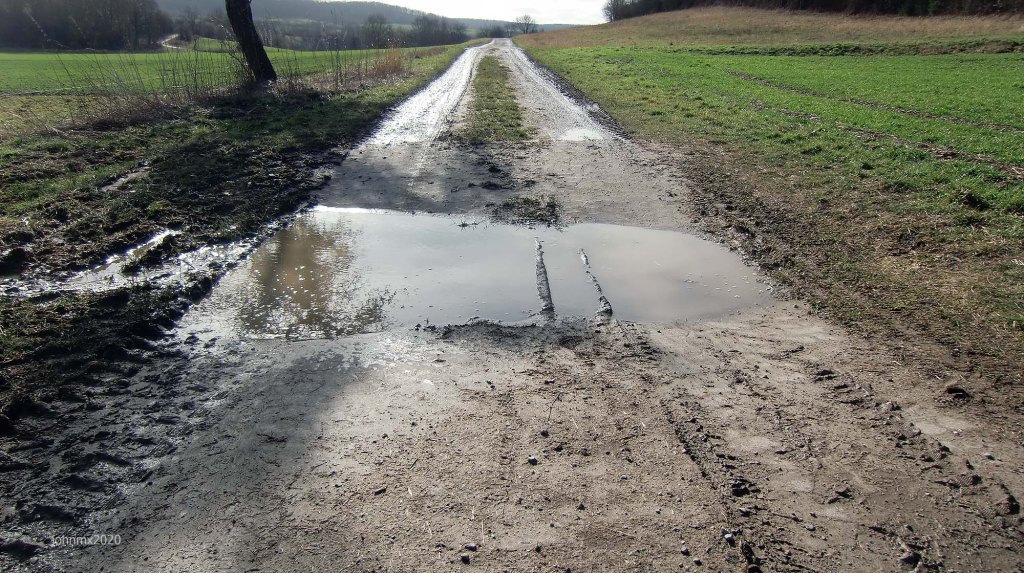
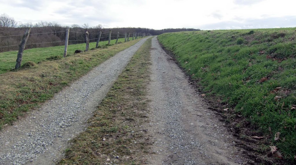
The route features a mix of gravel, dirt, concrete (farm/forest) plus tarmac public cycle paths and roads.
Concrete farm roads
On the Gutingi All Along the Watchtower ride there are concrete farm roads which are anything but smooth, they can be very muddy and a challenge in themselves.
GPS
Garmin Connect: https://connect.garmin.com/modern/activity/8427161674
Strava: https://www.strava.com/activities/6797758500
Kamoot: https://www.komoot.com/tour/697019546
Website: All Along the Watchtower in Gö – March 9 2022 Gravel Ride

1625 – The Gleichen Castles and the Diemarden Watchtower
Sign
The route is not signed, we offer a GPS, but you can choose to follow your own direction.
Take Note
The All Along the Watchtower is a suggested cycle tour route and not a race or a contest, should you choose to follow our description or a GPS of the outlined route you do so at your own risk.
It is your responsibility to ride in a safe and in a comfortable manner suited to your own estimated skill or fitness level.
Gravel categories (this is purely subjective & made up by us)
We have graded the gravel 1 to 5 with 5 being the roughest (there is also an Hors Cat for very extreme).
Cat 1 – mostly hard packed and rideable on almost all bikes.
Cat 2 – often hard packed, a little rougher, potholes and challenging.
Cat 3 – loose surface, more ruts & potholes, gradient changes, bigger stones with greater caution required. (may include downhill or a turn)
Cat 4 – very rough, loose with larger stones and deep ruts/potholes.
Cat 5 – as 4 but may also be downhill, maybe tight turns or with single track and ruts.
HC – Mind bogglingly hard.
Gutingi All Along the Watchtower
Gravel: 34.9km
Farm roads/cycle paths: 11.0km
Public roads: 4.5km
Total 50.4km
Warte
1 Wartbergswarte (Zingel der Warte) @3.5km
2 Die Rieswarte @10.6Km
3 Roringer Warte (Berwinkelswarte) @16.4Km
4 The Kehr/Hainholz Warte @26.7Km (Lost/Hat verloren)
5 Diemardener Warte: @38.9Km
6 Rosdorfer Warte (Wartburg) @46.6km
7 Dreckwarte @50.8km
Principle Climbs , 752m of Elevation.
Sector/Max %/km
Sector 1a: 13.5% – 1.5km (Hainberg)
Sector 8: 9.6% – 3.7km (Nikolausberg – gravel/asphalt)
Sector 14: 10.1% – 2.8km (Kehr)
Sector 22b: 13% – 0.7km (Klein Lengden)
Sector 23a: 12% – 0.7km (Diemarden/Diemardener Warte)
Sector 27a: 14.3% -0.3km (Wartburg/Rosdorf)
Want to ride it?
This is an informal ride and a suggested route only. If you would like to ride it with us do make contact. Or of course you may ride it at your own time and if you do, it would be great to hear from you – https://veloklubhaus.com/contact/.
Start Schillerwiese: 0km

At the Battle of Jena–Auerstedt (1806) Napoleon Bonaparte defeated a combined Prussian/Saxony Army and occupied the 460 states that made up ´Germany´ at the time.
Napoleon subsequently reduced the myriad of statelets once overseen by the Holy Roman Empire (Austria) to just 32 and he made his younger brother Jerome monarch of Westphalia, which included Göttingen.
It is said that Jerome would meet his lovers in the pavilion in the Schillerwiesen Park.
Just along fom this spot is Calsow Strasse, a typical Göttingen street lined with villas. The Göttingen Tageblatt newspaper as part of their coverage of the end of World War Two in May 1945 report that US Army tanks engaged German fighting units near Merkel Strasse. This fight at this spot is not unexpected because German rear guard elements would have used this road as it is the route to the Harz Mountains where German troops were ordered to muster at what was called Fortess Harz.
Sector 1a: Cat 1 @0.7 – 1.7 – 1km (a+b)
Climb: Max 13.2% – 1.5km

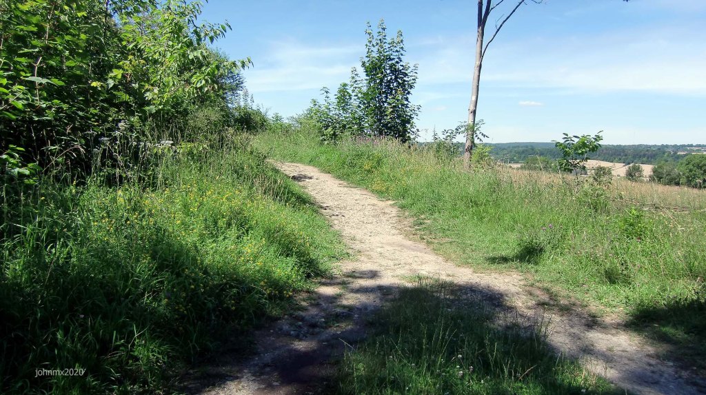
Sector 1b: Cat 3
Dirt trail.

Sector 2: Cat 1 @1.7 – 2.4 – 0.7km

Sector 3a: Cat 2 @2.4 – 2.7 – 0.3km (a+b)

Sector 3b: Cat 2

Sector 4: Cat 4 @2.7 – 3.2 – 0.5Km
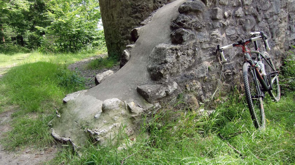
Along a stretch of Landwehr with an old stone surface.


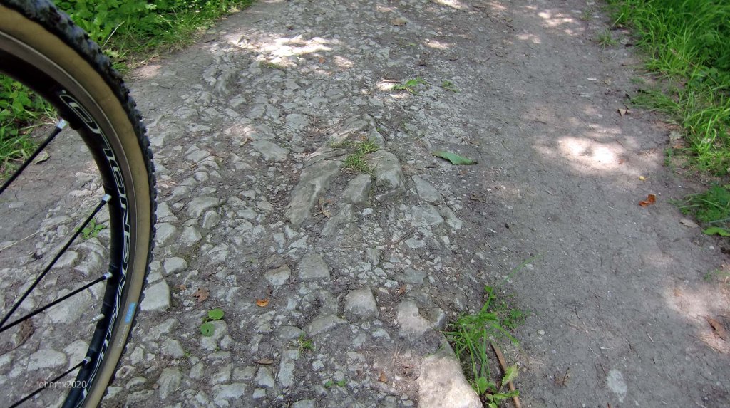
These twisted intertwinned thornbranches allow us a glimpse of what the Landwehr may have looked like.
View to the Roringer Warte
The Warte were linked in a chain that allowed each to observe one another – at the top of the main road to the Harz is the Roringer Warte now obscured by trees.

Sector 5a: Cat 1 @3.2 – 4.0 – 0.8Km (a+b+c)

Sector 5b: Cat 1


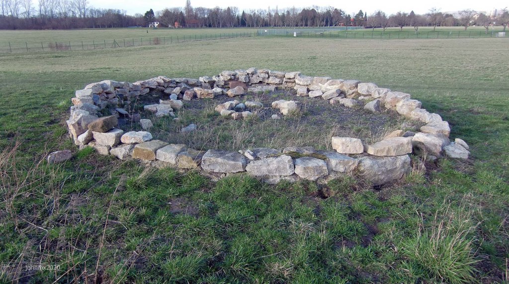
1 Wartbergswarte (Zingel der Warte) @ 3.5km

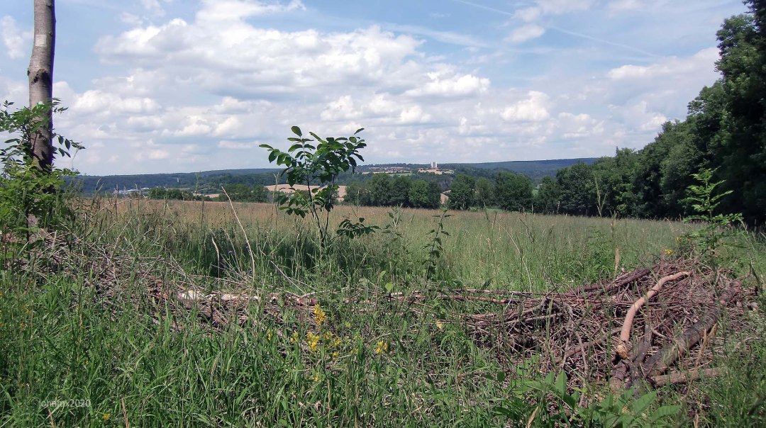
All that is left of the Wartbergswarte are earthworks and a modern representative wall with a tree growing through the middle where once a tower stood.


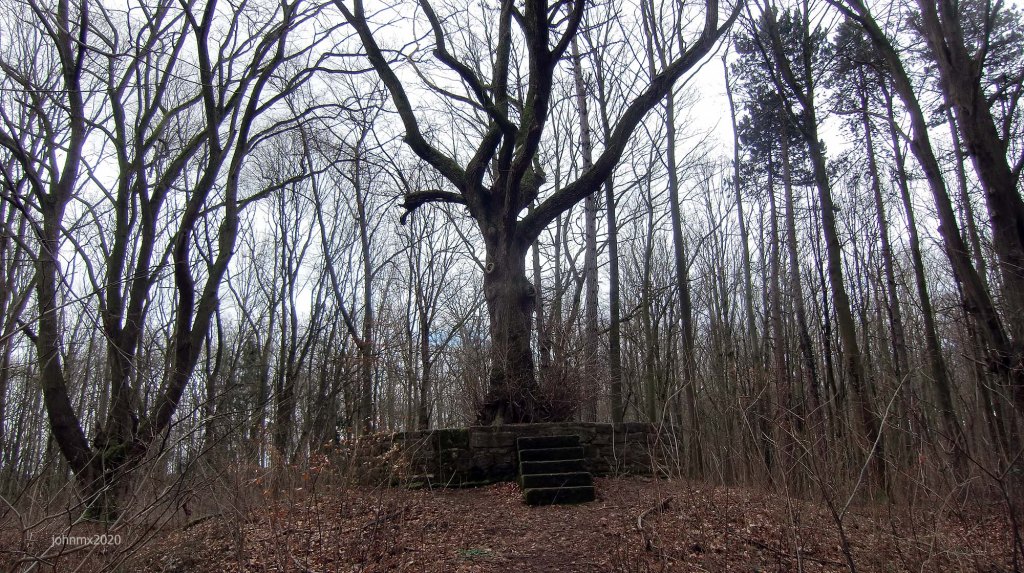
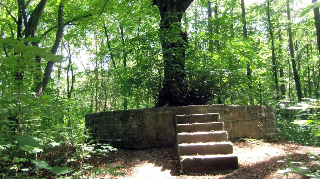
If there were no trees you could also see the Rosdorfer Warte on the Warteberg plus the Rieswarte and the Roringer Warte (at top of road in picture), not forgetting the Dreckwarte and possible the Diemarden Warte all visited on this ride.
Sector 5c: Cat 1

Sector 6a: Cat 2 @4.0 – 4.8 – 0.8Km (a+b)

Sector 6b: Cat 4
STEEP descent on a loose surface.

Tonollo @4.9Km
Cross the B27 main road at the traffic lights.

Sector 7: Cat 1 @5.1 – 6.3 – 1.2Km
Go right after B27 and then sharp left.

Sector 8: Cat 2 @6.3 – 7.3 – 1.0Km
Climb: 9.6% Max – 3.7km
Go left onto Gravel and then tarmac.

Nikolausberg @ 8.0km
Bakery Hermann GmbH, Senderstr. 2, 37077 – https://baeckereihermann.de…
Sector 9a: Cat 1 @9.0 – 10.6 – 1.6Km (a+b)

To the right is a radio mast.

Sector 9b: Cat 1
Go left.

2 Die Rieswarte@10.6Km

The second of seven mediaeval watchtower sites on this ride, part of a chain around Göttingen – More Here.

Sector 10a: Cat 1 @10.6 – 12.5 – 1.9Km (a+b
Sector 9b end in reverse.

Sector 10b: Cat 1

Sector 11a: Cat 1 @13.8 – 16.4 – 1.9Km (a+b+c) – Roringer Warte Loop (6.4km)

Sector 11b: Cat 1

Sector 11c: Cat 3
Grass /single track gravel trail with a kick up.

3 Roringer Warte (Berwinkelswarte) @16.4Km
The Roringer Warte is the third of seven watchtowers built in the 1400s featured on this ride, it oversees the main road into Göttingen from the Harz Mountains.


Sector 12: Cat 2 @18.5 – 20.1 – 0.6Km
After a long decsent on fast well paved farm roads we loop back onto sector 11b and we ride it in reverse.

Sector 13: Cat 3 @20.1 – 23.5 – 3.4Km
Left onto the Bratental long descent – this features pot holes, water culverts and other issues taken at speed.

Tonollo @23.5Km
Crossing the B27 main road at the traffic lights and then on toward Herberhausen.

Herbehausen @24.8km
There are pubs and a cool general store with a cafe – http://www.dorfladen-herberhausen.de/.

Sector 14: Cat 2 @25.0 – 26.7 – 1.7Km
Climb: 10.1% Max – 2.8km

4 The Kehr/Hainholz Warte @26.7Km
Atop the Hainberg Forest.

There are wild boars at the Kehr to admire and there is a cafe, the area is very busy with walkers etc. (No toilets)
The Hainholz Warte was situated at this location, but there is now no trace of it.
Here and for a few seconds we pop on to what used to be part of the main road into Göttingen and is now a gravel trail, and also doubled up as a race car circuit. Silver Auto Unions and Mercedes racing cars featured here in the 1920´s. The long tarmac descent of Bismarck Strasse was also a part of the circuit and it remains a public road open to all traffic.
Sector 15a: Cat 2 @26.9 – 28.0 – 1.1kmKm (a+b)
Broken tarmac with the Boars safely behind a fence to your left.

Sector 15b: Cat 2 or Cat 3
A choice, stay on the broken tarmac via the gate or enter a section of cat 3 single track to your left.

Kesterlingroder Feld @28.0Km
Once a huge military Nato Panzer training area part of a strategically important forward fighting NATO base from 1949 until the 1990’s. Now gone are Centurions, Tigers and Leopards replaced by idyllic meadows, rich in wild orchids, rare birds and wild cats.
A local feud saw the village here very badly affected and subsequently it was wiped off the map during the 30 Years War. All that was left was a manor house which finally succumbed to NATO war games.

Sector 16: Cat 1 @28.0 – 28.3 – 0.3Km
Concrete Panzer Weg.

Sector 17: Cat 2 @28.3 – 28.3 – 0.5Km
The left option with a third to the left of the notice boards.

Leopard Bath
The right-hand turn takes you to the old Leopard bath.


Sector 18: Cat 3 @29.1 – 29.3 – 0.2Km
You fly down a tarmac road, hit first a concrete section and then rough gravel.

Sector 19a: Cat 3 @29.3 – 31.8 – 2.5Km (a+b)
A great single track descent through the trees.

Sector 19b: Cat 2
The trail to Klein Lengden.

Sector 20a: Cat 2 @31.8 – 33.3 – 1.5Km (a+b)

Sector 20b: Cat 3
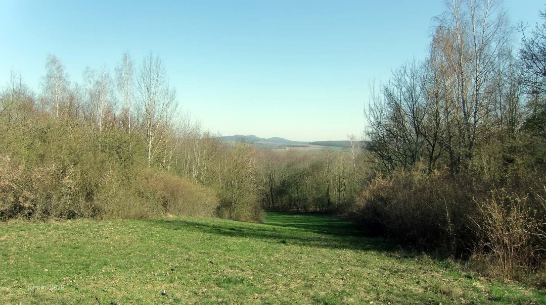
The Gleichen Hills on the horizon.

Cross the L569 @33.3km
In the final days of World War Two along this road in April 1945, elements of the US 2nd Infantry Division went into action against two columns of Wehrmacht. The US army subsequently took many prisoners as they consolidated their control of Göttingen and the surrounding area.

Sector 21a: Cat 2 @33.4 – 34.0 – 0.6Km (a+b)
Loose stones and a tight right hand turn.

Sector 21b: Cat 2
Right turn.

Garetal/Steinmuhle @34.0Km
Next to Steinmuhle/Gartetal is the historic Spinnerei (in the spring and summer there is a cool outdoor cafe here) and it tells the story of a decline of the local wool industry (and with it the rebirth of the forests in the area). At the Steinmühle you cross and follow for a while the now lost Gartetalbahn (1897-1957) narrow gauge railway which travelled between Göttingen and Duderstadt.


Sector 22a: Cat 1 @34.9 – 36.8 – 1.9Km (a+b+c)
The shelter is where the Klein Lengden narrow railway station used to be.

Sector 22b: Cat 2
Climb: 13.0% max, 0.7km.


Sector 22c: Cat 3
A gnarly descent into Diemarden.

Diemarden@37.6Km
Sector 23a: Diemardener Warte: Cat 2 @38.2 – 39.8 – 1.6Km (a+b)
Climb: 12.0% max, 0.7km in length – 11%, at first, then levels out and peaks at 12.

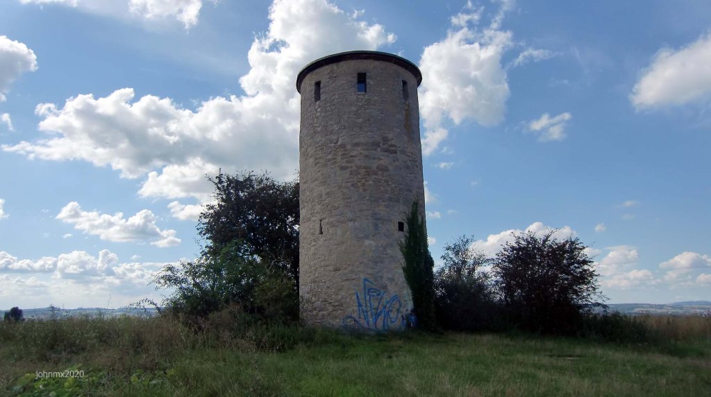
5 Diemardener Warte @38.9Km

The most complete Warte on route and I have been told a young family lived there in the period of housing shortage after WW2.

Sector 23b: Cat 3
Fast descent with rough sections after the watchtower.

Sector 24a: Cat 2 @41.1 – 42.9 – 1.8Km (a+b+c)

Sector 24b: Cat 2

Sector 24c: Cat 2

Sector 25: Cat 2 @43.3 – 43.4 – 0.1 km
Take care crossing the B27.

Sector 26a: Cat 2 @43.6 – 45.2 – 1.6km (a+b+c)

Sector 26b: Cat 2
A wooden bridge is ahead.


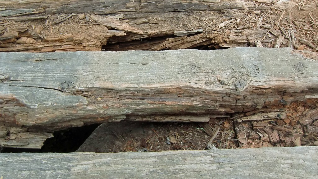
Take care the bridge has a few holes!
Sector 26c: Cat 1

At this point looking south along the Leine Valley upon the high ground in front of Niedernjesa we can see the Weinzenberg. Until 1570 a warte once stood here flanked by landwehr stretching into the distance.
We look but do not visit it.


Sector 27a: Cat 2 @46.2 – 47.1 – 0.9Km (a+b+c)
Wartburg Climb: 14.3% max – 0.3km

Sector 27b: Cat 3
Single track in the woods.

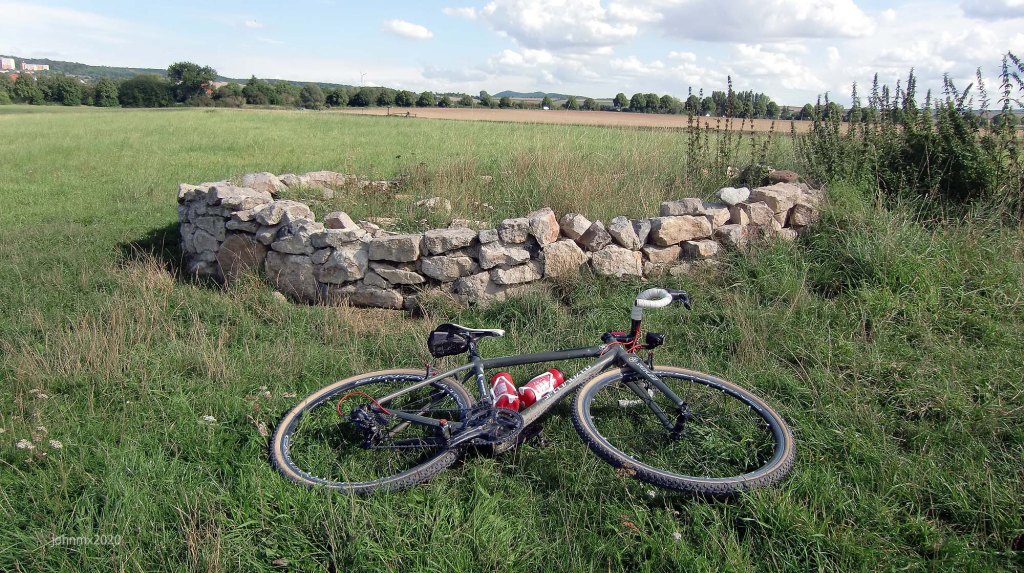
6 Rosdorfer Warte (Wartburg) @46.6km

All that remains are impressive earthworks and a few stones, but in its day this site gave clear views (no trees) in every direction including other towers in the chain surrounding Göttingen.
The area is pretty cool with lots of single track and there are plenty of good spots to practice your cyclo cross skills.


Sector 27c: Cat 3
More single track out of the woods.

The view across to the Gleichen Castles and the valley now obscured by trees
Sector 28: Cat 3 @47.1 – 47.3 – 0.2Km
Sector 27a in reverse – Wartburg climb.

Sector 29: Cat 1 @48.8 – 49.1 – 0.3Km

Sector 30a: Cat 1 @50.1 – 50.8 – 0.7Km

Sector 30b: Cat 1

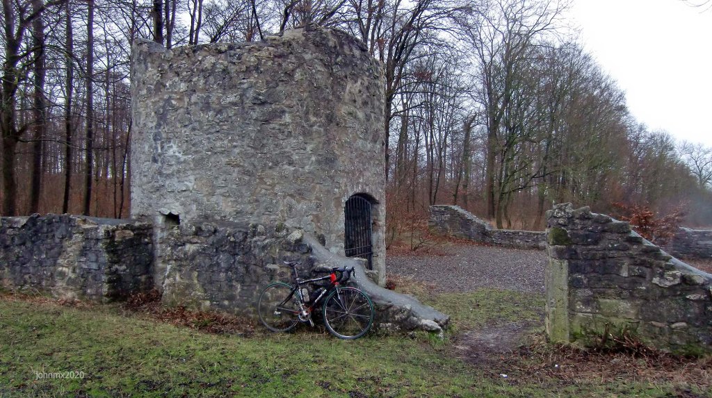
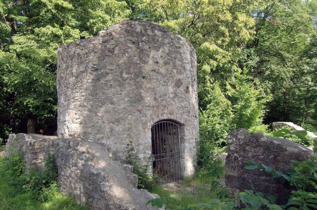
7 Dreckwarte@ 50.8km

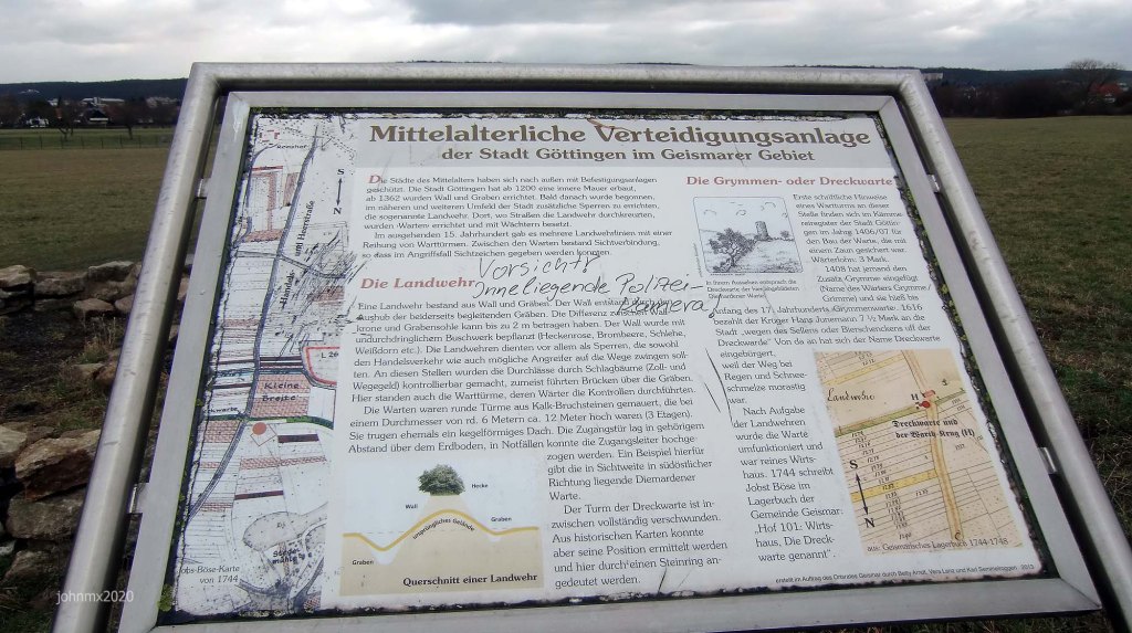
This pile of stones is not actually the old mediaeval watch tower, but a symbolic replica is positioned where it once stood. It is the last of seven watchtower sites we visit, part of a chain of 11 guarding the approaches to Göttingen built in the 1400s. For many decades the town of Göttingen had asserted itself over the regional nobles leading to the destruction of castles at Grona and Harste plus many fortified manor houses etc. The towers therefore also acted to assert its authority. The landscape was shaped with hawthorn hedgerows and earth works to channel access along specific routes. This also meant that Göttingen could collect taxes at the towers and monitor movement in and out.

Ride End @ 50km
On completion of the ´Gutingi All Along the Watchtower´ ride I hope playing Jimi Hendrix in your head helped, especially on the climbs.
The former military sites on route are now romantic ruins and peaceful, but once they were often the difference between life or death.
Despite the drumbeats of war echoing across Europe because of the invasion of Ukraine by Russia, I remain grateful to live in a period of peace for which Europe has never seen before and to have the opportunity to pedal my bike this day.
Gravel/Waypoints
Start Schillerwiese @0km
Sector/Cat/@/end/total
Sector 1a: Cat 1 @0.7 – 1.7 – 1km (a+b)
Sector 1b: Cat 3
Sector 2: Cat 1 @1.7 – 2.4 – 0.7km
Sector 3a: Cat 2 @2.4 – 2.7 – 0.3km (a+b)
Sector 3b: Cat 2
Sector 4: Cat 4 @2.7 – 3.2 – 0.5Km
Sector 5a Cat 1 @3.2 – 4.0 – 0.8Km (a+b+c)
Sector 5b: Cat 1
1 Wartbergswarte (Zingel der Warte) @ 3.5km
Sector 5c: Cat 1
Sector 6a: Cat 2 @4.0 – 4.8 – 0.8Km (a+b)
Sector 6b: Cat 4
Tonollo @4.9Km
Sector 7: Cat 1 @5.1 – 6.3 – 1.2Km
Sector 8: Cat 2 @6.3 – 7.3 – 1.0Km
Sector 9a: Cat 1 @9.0 – 10.6 – 1.6Km (a+b)
Sector9b: Cat 1
2 Die Rieswarte @10.6Km
Sector 10a: Cat 1 @10.6 – 12.5 – 1.9Km (a+b
Sector 10b: Cat 1
Sector 11a: Cat 1 @13.8 – 16.4 – 1.9Km (a+b+c)
Sector 11b: Cat 1
Sector 11c: Cat 3
3 Roringer Warte (Berwinkelswarte) @16.4Km
Sector 12: Cat 2 @18.5 – 20.1 – 0.6Km
Sector 13: Cat 3 @20.1 – 23.5 – 3.4Km
Tonollo @23.5Km
Herbehausen @24.8km
Sector 14: Cat 2 @25.0 – 26.7 – 1.7Km
4 The Kehr/Hainholz Warte @26.7Km
Sector 15a: Cat 2 @26.9 – 28.0 – 1.1kmKm (a+b)
Sector 15b: Cat 2 or Cat 3
Kesterlingroder Feld @28.0Km
Sector 16: Cat 1 @28.0 – 28.3 – 0.3Km
Sector 17: Cat 2 @28.3 – 28.3 – 0.5Km
Sector 18: Cat 3 @29.1 – 29.3 – 0.2Km
Sector 19a: Cat 3 @29.3 – 31.8 – 2.5Km (a+b)
Sector 19b: Cat 3
Sector 20a: Cat 2 @31.8 – 33.3 – 1.5Km (a+b)
Sector 20b: Cat 3
Cross the L569 @33.3km
Sector 21a: Cat 2 @33.4 – 34.0 – 0.6Km (a+b)
Sector 21b: Cat 2
Garetal/Steinmuhle @34.0Km
Sector 22a: Cat 1 @34.9 – 36.8 – 1.9Km (a+b+c)
Sector 22b: Cat 2
Sector 22c: Cat 3
Diemarden @37.6Km
Sector 23a: Diemardener Warte: Cat 2 @38.2 – 39.8 – 1.6Km (a+b)
5 Diemardener Warte @38.9Km
Sector 23b: Cat 3
Sector 24a: Cat 2 @41.1 – 42.9 – 1.8Km
Sector 24b: Cat 2
Sector 24c: Cat 2
Sector 25: Cat 2 @43.3 – 43.4 – 0.1 km
Sector 26a: Cat 2 @43.6 – 45.2 – 1.6km
Sector 26b: Cat 2
Sector 26c: Cat 1
Sector 27a: Cat 2 @46.2 – 47.1 – 0.9Km (a+b+c)
Sector 27b: Cat 3
6 Rosdorfer Warte (Wartburg) @46.6km
Sector 27c: Cat 2
Sector 28: Cat 3 @47.1 – 47.3 – 0.2Km
Sector 29: Cat 1 @48.8 – 49.1 – 0.3Km
Sector 30a: Cat 1 @50.1 – 50.8 – 0.7Km
Sector 30b: Cat 1
7 Dreckwarte @ 50.4km
Lest we forget that war means death
DE Home – ENG Home – DE Route – ENG Route
Manifest – Galerie – Jimi Hendrix – Links – Air War – WW2 – Gutingi Rides
Brevet Card – Facebook – Strava – Komoot
